

FINDING CENTRE
This project sets out to find what lies at the actual geographical centre, the point from where the landscape of the United Kingdom radiates from. Where is it? What does it look like? Learning that there are more than one omphalos claimed for England alone the project is now on going to find all omphalos in the United Kingdom, Great Britain and the countries contained within.
Do these centres on the landscape shed any light through history and geography to clarify the rhetoric in today’s continuously changing cultural, economic, geographical and constant political debates of the standing of the United Kingdom within Europe post Brexit and the rest of the World?
The centre of a land mass holds no romantic or ethereal connotations as every cartographer and surveyor knows there is no such absolute. The location of, for example, Great Britain's true centre may never be entirely clear because of debates over what method should be used to calculate and the fact that the islands shape changes with tides and erosion.
The basic problem is one of determining the centre of an irregular three-dimensional object on the surface of a sphere. Not only that, but the irregular landscape of the United Kingdom is surrounded by water which keeps moving and is responsible for changing the shape of this geographical mass on a daily basis.

Midland Oak, Royal Leamington Spa, Warwickshire - September 2016
The Midland Oak was an oak tree that grew near the boundary between Lillington and Royal Leamington Spa, Warwickshire. This current Midland Oak was planted in 1988, grown from an acorn from the original tree that was reputed to mark the centre of England.

The Guns Memorial, Near Stretton on Dunsmore, Warwickshire - September 2016
The memorial is dedicated to the incomparable 29th Division of the British Army. On the 12th March 1915, prior to their departure for Gallipoli, in Turkey, H.M. King George V reviewed his troops here. A plaque on the memorial states that it, "stands in the centre of England where Telford's coaching-road from London to Holyhead is crossed by the Roman Fosse Way".

Meriden, Coventry, West Midlands - September 2016
Meriden has traditionally been regarded as the centre of England. However the origins of the tradition are unclear. A Grade II listed sandstone pillar on the village green carries a plaque referring to this tradition. The monument was originally located in the old centre of the village near the Pool where the road comes in from Berkswell. The monument was moved to what we know as the village green in 1822 and was moved again to its current position on the green in 1952.

Centre Field, Lindley Hall Farm, Higham on the Hill, Leicestershire - September 2016
In 2002, the Ordnance Survey defined a field at Lindley Hall Farm as the geographical centre of England. A plaque denoting this point, and disputing the 'traditional' centre of England as being Meriden in the West Midlands, was erected by Ordnance Survey on 14th June 2013.

Appleby Inn Hotel, near Appleby Parva, Leicestershire - September 2016
Appleby Parva hamlet was calculated to be the centre of population of Great Britain in 2000 according to research by Professor Danny Dorling, University of Leeds. This centre of population has been plotted based on the weighted average population of every district in Britain, and with more people living in the south, the centre has been moving south east from Rodsley, west of Derby, since calculations in 1901. Appleby appears 3 times in the Domesday Book.

Black Horse Hill, Appleby Magna, Leicestershire - September 2016
The hamlets of Appleby Magna and Appleby Parva have been calculated to be the centre of population of Great Britain in 2000 according to research by Professor Danny Dorling, University of Leeds. This centre of population has been plotted based on the weighted average population of every district in Britain, and with more people living in the south, the centre has been moving south east from Rodsley, west of Derby, since calculations in 1901. Appleby appears 3 times in the Domesday Book.

Church Flatts Farm, Coton in the Elms, Derbyshire - September 20
The Ordnance Survey have calculated that Church Flatts Farm is the furthest point from the sea (at the mean low water line) in the UK. This place in Coton in the Elms was chosen as equidistant from Fosdyke Wash in Lincolnshire; White Sands between Neston in Cheshire and Flint, Flintshire in Wales; and Westbury-onSevern in Gloucestershire - all of which are 113 kms (70miles) away.

Wall Lane, Wall, Lichfield, Staffordshire - September 2016
This section of Wall Lane entering Wall is deemed the farthest from high tide mark (including tidal rivers) in England. This lane crosses the Roman way of Watling Street which was an important staging post on the Roman military road to north Wales.

Dicky's Lane, Woodseaves, Staffordshire - September 2016
The centre of a rectangle enclosing precisely all of England and Wales falls outside number 4 in this block of houses on Dicky's Lane in Woodseaves.

69 Stretton Road, Morton, Alfreton, Derbyshire - September 2016
Generations of Morton residents have referred to this Oak tree opposite 69 Stretton Road as the Centre of England Tree. There was once a seat beneath it and a Bus Request Stop when the Morton Bus Company was operating.
The earliest evidence to this Centre of England claim is from an article printed October 1st 1910 in Homers Weekly which included specific details, two photographs and an apparent endorsement by the Ordnance Survey.

Whalley Field, Lancashire - September 2016
The centre of Great Britain if you exclude islands other than the island of Great Britain itself lies in a field outside Whalley, Lancashire.

Dunsop Bridge, Clitheroe, Lancashire - September 2016
For years the village of Dunsop Bridge was cited as the geographic centre of Great Britain. In 1992 British Telecom installed its 100,000 payphone marking this exact spot. This telephone box was unveiled by Sir Ranulph Fiennes on 29th June 1992 with a plaque inside stating, "You are calling from the BT payphone that marks the centre of Great Britain." However calculations by Ordnance Survey in 2013 showed this point to actually be 4 ½ miles (7kms) away and in 2016 this payphone is being removed due to it's lack of use.

Brennand Farm, Forest of Bowland, Lancashire - September 2016
The track that runs along Lower and Upper Brennand Farm near Dunsop Bridge in the Forest of Bowland, leads you, (as well as some trekking across peat covered fields to reach the nations heart beside Whitendale Hanging Stones), to the geographical centre of the United Kingdom.
This centre location was calculated by Ordnance Survey as the centroid of the two-dimensional shape of Great Britain, including all its islands.
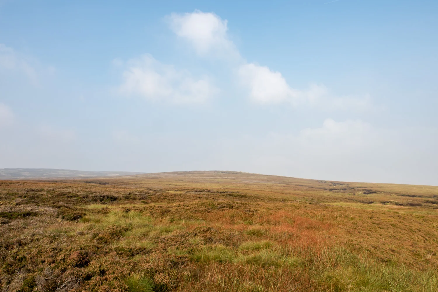
Whitendale Hanging Stones, Forest of Bowland, Lancashire - September 2016
At the top of this hill lies an undistinguished clump of grass surrounded by peat bog. It is at this exact point, Ordnance Survey grid reference SD 64188.3 56541.43, that lies the centre of Great Britain factoring in its 401 associated islands.
The gravitational method is the standard arithmetic principle, and standard scientific application, of determining the centre of an irregular two-dimensional object. As such it has been used by everyone from Captain Cook to Nasa.
The location of Great Britain's true centre may never be entirely clear because of debates over what method should be used to calculate it and the fact that Great Britain's shape changes with tides and erosion as well as being an irregular object surrounded by water.
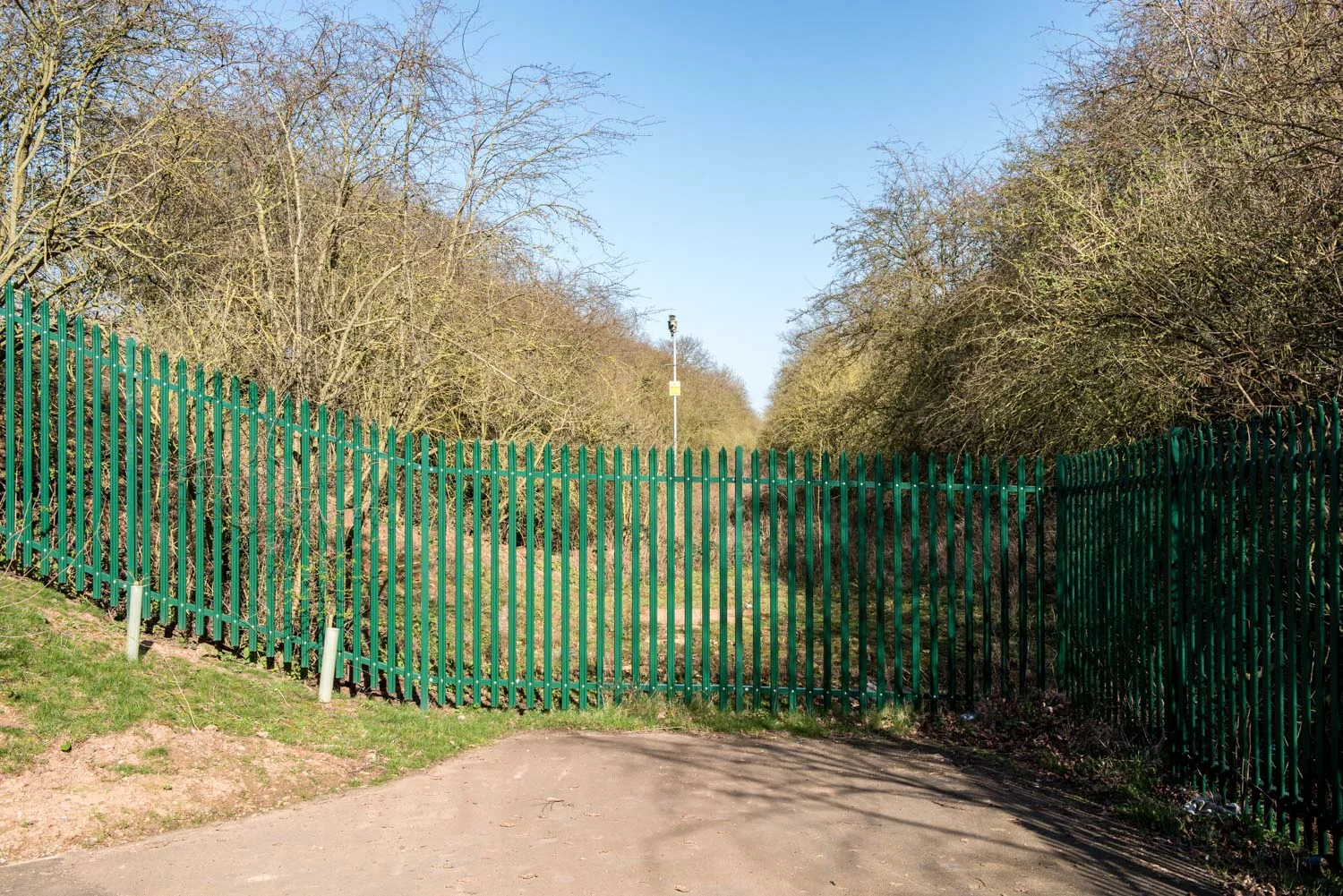
Dismantled Railway, Weddington, Warwickshire - March 2017
In 1941 Sir Charles Arden-Close, Director General of the Ordnance Survey defined the centre point of any country to be, "that point through which any great circle will divide the country into two part of equal moment." His centre of England was, "on Watling Street, 4 miles ESE of Atherstone, close to the railway bridge, between the villages of Higham-on-the-Hill and Caldecote." Today the railway line is disused and turned into a national cycle path.

Lichfield Cathedral, Lichfield, Staffordshire - March 2017
Lichfield Cathedral is the only medieval English Cathedral with three spires often referred to as 'the Ladies of the Vale'. Worship has taken place on this ground since 700AD with the existing Gothic style Cathedral built 1195 - 1340. At the time of Bede, the ninth century, Lichfield was considered the omphalos, the centre of England.

Carfax, Oxford, Oxfordshire - April 2017
From the ancient tale of Mabinogion Lludd Llaw Ereint, a legendary hero from Welsh mythology, had the island of Britain measured in length and breadth to find the centre point where a plague would be eradicated by digging a pit under the exact point where dragons would fall down exhausted after fighting; this measured centre point was found to be in Oxford. Carfax is the ancient heart of Oxford: its name is derived from Quadrifurcus, where the four roads from the four city gates meet. It is dominated by the thirteenth-century church tower of the former St. Martin's Church.

Croft Hill, Blaby, Leicestershire - March 2017
Croft Hill is recognised as the ancient centre of England used as a beacon where several kings surveyed their kingdom. Because of its individual shape and its position it was used in Saxon times as a place of assembly where matters of importance were discussed and settled.
In 836 King Wiglaf of Mercia was joined by the Archbishop of Canterbury and eleven of his bishops and three abbots, besides twenty-two laymen of authority and influence to witness a grant of land by Wiglaf to the monastery of Hanbury in Worcestershire.
It now sits on the edge of the largest quarry in the United Kingdom.

High Cross, Venonae, Leicestershire - April 2017
At the top of this hill stands a wayside monument marking the centre of Roman Britain at the cross roads of the two principle Roman roads of Watling Street and Fosse Way, and to commemorate peace between France and Britain. At 443 feet above sea level, High Cross is a natural vantage point which dominates the surrounding countryside in all directions.

Arbury Hill, Northamptonshire - March 2017 Besides the claim to be a centre of England, Arbury Hill can factually claim to be the highest point in Northamptonshire standing at 225m (738ft) with an Iron Age settlement located on the summit. The site has for a long time been regarded as fortified and indeed was first described as such in an Anglo-Saxon Charter of 944. There the site is called the 'ealden burh æt Baddanbyrig' and the present name of the site seems relatively modern for it does not appear in the records until 1712.

Appleby Magna, Leicestershire - April 2017
The parish of Appleby has been calculated by Professor of Geography Danny Dorking, now of the University of Oxford, based on the weighted population average, to be the centre of population of Great Britain. As population increases in the south this centre point gradually moves south. If the population of Britain were obliging, and current rates continued, it would be at the south coast at Worthing in the year 2771!

Watling Street Cycle Underpass, Route 52, A5, Warwickshire - April 2015
In 1941 Sir Charles Arden-Close, Director General of the Ordnance Survey, defined the centre point of any country. He claimed the centre of England was, "on Watling Street, 4 miles ESE of Atherstone, close to the railway bridge, between the villages of Higham-on-the-Hill and Caldecote." This is the route of the old railway line passing under the A5 that is now part of the National Cycle Route 52.

The Bull's Head, Meriden, Coventry - April 2017
As well as the Grade II listed sandstone pillar on the village green, a few hundred metres down the road lies a brass plaque on the floor of the Bull's Head also claiming to mark the centre of England.