

REFERENDUM
ENGLAND & SCOTLAND REFERENDUM
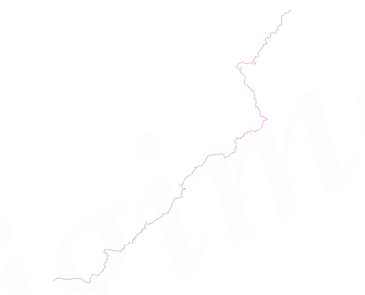
Referendum is a photographic series that explores the tangible and intangible border along the 108 mile geographical stretch between England and Scotland from Berwick-upon-Tweed in the east to Gretna Green in the west.
Referendum contributes to the ongoing political and economic debate on the Union that despite the 'No' vote declared in September 2014 - the debate continues.
The landscape is considered in three ways; the sweep of the grand romantic vistas; the accumulation of political rhetoric within the historical and media documentation and the minutiae of borderline ephemera rendered through to the scientific gaze of the microscope connected to this space.
Landscape is ever present and ever constant; whatever the outcome the landscape will always remain.

Border Line
The geographical line of the border between England and Scotland that stretches for 108 miles, legally established in 1237 by the Treaty of York.

A small, single-story building with a gray, textured exterior and a set of steps leading to a side entrance, situated on a grassy area with no visible people, under an overcast sky, surrounded by leafless trees and a white fence along the foreground.

A white building with black accents, sign reading "First House Scotland" and surrounded by leafless trees and a road with a green grassy area in the foreground.

River Sark
The centre of the River Sark forms the border on the western side between England and Scotland.

A foggy landscape with a calm river reflecting leafless trees and bushes on both sides.

A wide view of a green field under a cloudy sky, with a distant tree line on the horizon.

A line of leafless trees with tangled branches, undergrown grass and weeds, and a dark forest background.

Scots' Dike
The path way entering Scots' Dike, the straightest stretch of the border between England and Scotland.

A dense forest with tall, thin trees and a leaf-covered ground.

Englishtown 2
The border marked by the change in colour of the tarmac at Englishtown.

A tranquil river flowing through a forest with leafless trees and rocks in the water.

A narrow country road crossing a small stone bridge, with frost on the grass and leafless trees on either side, leading into a hilly area with dry grass and sparse bushes.

A rural landscape with a dry stone wall, leafless bushes, and leafless trees on a hillside under a partly cloudy sky.
Coldstream Bridge, Coldstream, Borders, Scotland
Coldstream, Borders, Scotland

Union Bridge
Union Bridge crosses the border and when opened in 1820 it was the longest rough iron suspension bridge in the world with a span on 137 metres, (449ft), and the first vehicular bridge of its type in the United Kingdom.

A rural landscape with an open field, a metal gate, a wooden fence, and a sky with some clouds.

West Along Carter Bar
In 1575 Carter Bar was the scene of the Raid of Redeswire, one of the last large-scale battles between the England and Scotland.

A rural landscape with a small wooden bridge crossing a stream, a dirt path leading uphill past a fenced grassy area, and rolling hills in the background with patches of snow and sheep grazing.

Rolling hills with patches of snow and a cloudy sky over a rural landscape

Snow-covered pathway leading up a grassy hill with a wooden fence and signposts labeled 'Pennine Way'.

Act of Union 1707, Pennine Way 2013
The border between England and Scotland on the Pennine Way with the full text of the Act of Union overlaid, the legal document that brought the two nations together.

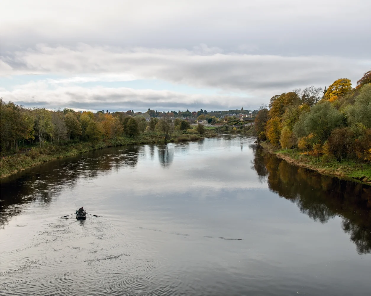
Fishing on the Border
Fishing in the middle of the River Tweed.
A narrow dirt trail on a rainy day, surrounded by trees and bushes, leading into an open field with a hill in the distance.

A dense, overgrown area beside a road with various green, brown, and yellow plants and bushes, some trees with green foliage.

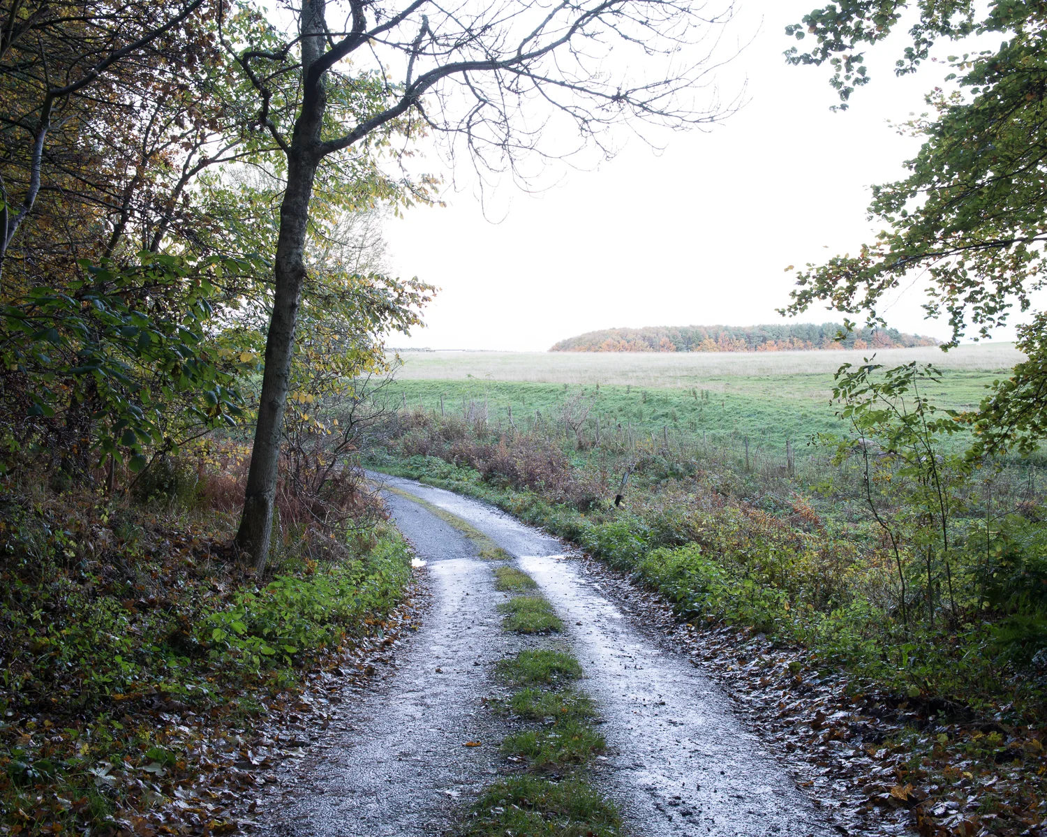
A narrow, dirt and gravel road with fallen leaves, flanked by trees and overgrown bushes, leading into a rural landscape.

A dirt country road with puddles, flanked by green grass and bushes, leading to open fields with a few sheep in the distance under a cloudy sky.

A winding rural road leading into Scotland, with a sign welcoming travelers, surrounded by trees and open fields under a cloudy sky.

A1 Border Wall
The remains of a border wall besides the A1.

A small brick and concrete monument with two white flagpoles in a round brick paved area, with a black bollard and a grass lawn on either side, near a road with a yellow food truck parked beside bushes and trees.

A small mobile snack stand with a sign reading "Nacarthus Border Review Snack Bar, Hot & Cold Food & Drinks" placed on a paved area with a stone monument and flags in the background, surrounded by open fields and trees.

Two gas pipeline markers in a grassy area with bushes in the background. The front marker has a blue label with white text reading 'GAS' and additional details, while the second marker behind appears grayer with some labels.

A1 Lay-by Border
The border at the A1 lay-by near Berwick-upon-Tweed. Gas pipe markers note English and Scottish Gas supplies.

A signpost marking a gas test point called 'CP 10 Remote (Scottish)', indicating a 'Cathodic Protection Test Point', next to a wooden fence, with grass and bush in the background.

A roadside border crossing with a small yellow kiosk that reads "Welcome to the Border" and a person standing nearby. There are two flags flying, a sign welcoming travelers to Scotland, and a red car parked near the kiosk. The road continues into the distance with trees and open landscape.

#indyref 2013, Berwick-upon-Tweed 2013
The border between England and Scotland at Berwick-upon-Tweed overlaid with text from twitter feed #indyref.

Open green fields with cows grazing, rolling hills in the background, and a clear blue sky with a few clouds.

A railway crossing sign indicating the boundary between England and Scotland, with flags, lions, and text, under a clear sky and green rolling hills.

A scenic coastal landscape with a wooden gate and a blue sign that says, 'Welcome to Scotland' and 'Fàilte gu Alba,' leading towards the ocean and rolling hills under a partly cloudy sky.

Calm ocean with gentle waves touching a rocky shoreline, under a light blue sky with some clouds.